The path to getting this trip underway almost had it not happening! Cortney and I were planning a trip somewhere for my birthday weekend and our original campsite looked amazing and not far from me and Gwyn. But then we heard some bad news, the campground was closing for the season the Monday prior to our trip weekend.
 |
Following Cortney into Snoqualmie Pass
|
We scrambled and asked around for other horse camp recommendations in the regional trail riding group and was told that the Ken Wilcox Horse camp was still open for the season.
It was SUPER cheap to stay there (5$ a day) and not too far (3-4hr) compared to our Plan C, which was an 8 hour drive away. So we both decided that Ken Wilcox sounded great!
We met up at a grocery store just off I-90 on the morning on my birthday (Oct 9) and started our caravaning into the Wenatchee National Forest
After Cle Elum (and the Washington State Horsepark!) we turned north into the east side of the Cascades and took a different highway up through Blewett Pass.
Right as we reached the sign for Blewett Pass (4400 ft above sea level) we turned onto a forest road and started the long climb UP. It was 9 miles from the highway turn to the campground and it was a LOOOOONG 9 miles of potholes, dirt, dust and some of the gnarliest road I have ever driven on with a horse trailer.
But as we climbed the peekaboo views were getting more prominent... and more distracting.
And some points of our drive were white knuckle inching a long on a definitely not two-vehicle wide road that crossed avalanche scree and old forest fire burns.
 |
| My whole rig was -parked- for this photo |
We did have to contend with a couple vehicles that were coming down. The first time wasn't so bad, we were able to all squeeze by without worrying about someone needing to be super close to the edge. The second vehicle was just after we crossed this narrow stretch! Thank goodness the timing worked out the way it did that there was room for our rigs to pass the guy.
 |
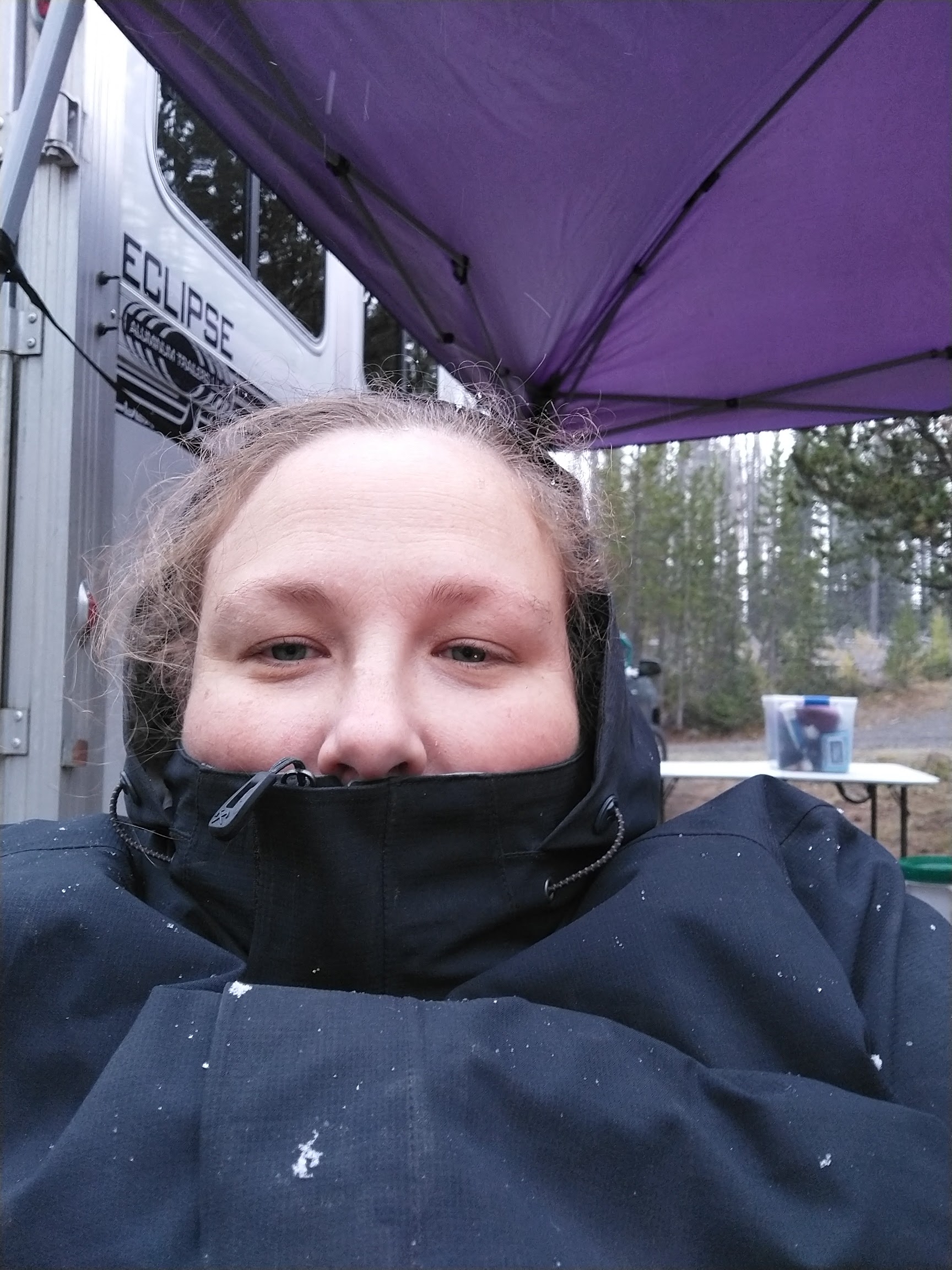
Arriving at the campground, absolutely filthy, covered in road dust
|
There were lots of campsites available, and there was one other horse group there (and two non-horse groups using the sites) We drove around to check them all out before settling on the best combo of sites where we could be next to one another.
Cortney and I both have the camping thing down. We got horses off the trailer and quickly got the high line up and had them settled with hay and water. I donned my birthday apparel and we set up most of camp.
 |
| Actually warm in camp! |
There was a line of trees between our trailers but the way we had parked meant we could put up both of our pop up tents and they'd connect enough to give us rain protection nearly seamlessly! And it was good tacking up rain protection for later.
We knew we wanted a Friday ride before we lost light so we got the horses tacked up and ready to go and then it was off to explore and find some trails to ride!
The first trail we tried out of camp was not well used and there was a TON of downed trees. The camp website had warned us that due to previous fires, deadfall was near certain and to be careful with trees.
 |
| The juxtaposition of the bright green, baby trees with the burned trunks was just pretty and eerie all at once |
We quickly discovered that the trail wasn't going to be passable. We tried off roading it but the density of downed trees combined with uncertain footing (and an unbalanced 5 year old Reign) wasn't going to be a good combination. We opted to turn around. Reign even tripped over a tree and Cortney came off, getting covered in charcoal in the process.
 |
| A solar powered well pump and trough for stock. You turn it on with a timer and it auto shuts off. Thanks BCHWW! |
Gwyn was uncertain of the trough and Reign didn't help when she decided to play in the water with her face.
 |
| Our campsite |
With the one trail being a bust, and us barely getting a mile of riding in, we set off on another trail that led out just to the north of our camp (to the right of the trees in the above picture)
This trail appeared FAR better maintained! We quickly came to a four way intersection and opted to go left. The trail took us up up up to the ridgeline above our camp!
From there we had amazing views looking west of the Cascades.
Looking east we could see more of the national forest. For you east coasters or anywhere with large amounts of deciduous trees, this isn't winter bare trees. Those are all supposed to be evergreens. What you're seeing is how the forests look as they recover from our forest fires. Those hills should all be green with bits of larch yellow.
We wound our way down from the ridge, stopping once to remove a stick that Gwyn was dragging along in her tail. It was massive!
The trail we were on eventually came back down to camp level and crossed the road we had driven in on and then dropped further down. We picked our way down the hillside, crossing tiny little rivulets that seemed to just appear out of the ground.
Even though we had dropped from where we started we found ourselves on another ridge edge looking into a valley.
The trail seemed to drop straight down into the valley and we followed the edge right where the hill ended and met the valley bottom.
 |
| Down in the valley that's only a valley because there are higher things around it |
 |
| Neither horse liked these crossings for some reason |
The trail came back in on the south side of Haney Meadow. We did not ride in the meadow as along with the deadfall warning came the warning that the meadow was the site of prior mining and you could basically fall into an abandoned mine shaft. Thank, we'll avoid that one.
 |
| Mt. Lillian is the peak to the left. |
I mean... technically we could take these back forest roads to get from one city to the other. Maybe for when I need to avoid fascists and ride to Canada. Technically... I can use the PCT from Cortney's house for that.

We settled back in at camp and tucked the horses in for the night and huddled around the fire. Cortney brought her mom's gas fire pit so we could minimize our danger to the remaining forest. We blanketed for the night and tucked in after a bit. The temperature didn't seem that bad but we were both bundled in preparation for bad weather. The clouds rolled in and got thicker.
I slept okay. I really need to work on getting a battery back up for my CPAP machine because I kept waking up, I think because I wasn't breathing again. I did wake up at one point and I was too hot! Not something I was expecting in early October in the Cascades.
But then I woke up because the wind suddenly picked up. And it sounded like rain blew in. Cortney and I both huddled in our respective trailers longer than we otherwise would have and when we both emerged, we were cocooned in our riding skirts and rain coats. No longer were tank tops going to be tolerable. We huddled in Cortney's trailer and cooked breakfast and made coffee that had the heat sucked out of it faster than we could drink it.
 |
| The trail out of camp. Our stuff was just to the left. The trees were creaking! |
But we are both endurance riders and weather isn't THAT big of block for either of us. And we were prepared for it. So dammit, we were going to ride.
Reign was being a terror and spooking at every wind gust. We tacked up under our canopies and then made extra sure they were tied down so they wouldn't blow away while we were gone.
 |
| Looking back toward where we had ridden yesterday |
We made our way vaguely north northwest and passed in and out of areas affected by the 2012 Table Mountain fire.
We eventually turned east and started a gradual climb up Mt. Lillian on a rather gentle grade as the rain began to pick up. As we reached an open area I realized that the rain was less falling and more piercing. It stung our cheeks. Oh... freezing rain, great!
We emerged onto the edge of the mountain. Ahead of us was sheer drops and slick stone. The path met a T junction. Cortney had us turn right, the sheer drops off to our left and we continued to climb Lillian. Eventually, she checked her GPS tracks and realized we should have turned left. So we turned around and backtracked, descending back to the scary, open viewpoint.
 |
Me pointing out the sheer mountain face that we were climbing along the edge of.
|
We passed the T junction and found more views, but a disappearing trail. We got pictures, and told our horses that we'd abandon them if they dropped off the edge.
My heartrate data shows that I was solidly in aerobic BPM. We were just walking.
 |
| I cannot see the trail anymore. |
We turned back and followed our trail from the T Junction, since I had remembered seeing a few turn offs lower down.
But even that led to disappearing trail. And while we could see our marker overlaid on where the trail should be, there was no visual evidence in reality.
But neither of us were overly concerned about getting lost. We knew we could easily regain the trail and the forest here was gorgeous to explore, and easily open for navigation.
Eventually, we made our way back down and picked up a different trail, one we had initially dismissed in favor of climbing toward Lillian. This was more dirt road than single track and a vehicle could easily navigate it.
Eventually it led to what appeared to be an open parking area for ATV and OTV users complete with trailhead signage indicating that if we wanted to be on the Upper Naneum trail (which we did) this was the way to go. So we followed.
The wind was severe and chapped our skin and whipped the horse's manes around.
Eventually we reached another promontory, rocky viewpoint and found day hikers! They informed us that the snow line was expected to drop to 5000 ft elevation, which stayed on our minds for a while after we rode.
 |
| Right after this moment, Reign spooked again from the wind gusts and Cortney opted to get off and walk for a bit. |
The sun was playing a teasing round of peekaboo while the wind harried us relentlessly.
These next pictures are from my phone (vs go pro screenshots) so they may be covering things I already had up above.
We encountered some OTVers who were thankfully powered down when we passed and we were headed in the opposite direction. These trails were multi use so running into them was a possibility. Both Cortney and I were super glad for how we encountered them (i.e. not near any open spaces leading to drop offs)
We made our way back down to our camp, chilled and ready for food.
We untacked and cooled everyone off and bundled up for the afternoon.
 |
| Note the leaning tree above Reign |
I opted to go for a walk to the meadow to try and warm up and brought my good camera along for the walk.

Kara enjoyed hunting small rodents.
We walked out to the camp entrance and followed the road only slightly further to reach the day parking for Haney Meadow.
 |
10 miles doesn't seem that far....
|
 |
| Between the color of the sky and the lack of green, I was getting REALLY big Michigan January vibes. |
Kara went for a romp in the stream that crossed the meadow, absolutely delighting in getting muddy despite the temperature.
Just walking back to camp was a work out. The thin air definitely affected me in my ability to breathe easily.
 |
| Me wondering where the fuck my hat was |
On our way back to camp I grabbed a BCHWW provided wheelbarrow and picked poo. Between poo picking and the walk to the meadow, we had warmed up significantly. We settled back down around the fire and watched as small white flakes began to drift down around us.
We watched the clouds get thicker over head and darker. The hiker's words echo'd and we discussed what our potential trigger would be for staying versus going. As we sat around the fire, small snowflakes began to pepper the ground. We laughed it off. Unless they started sticking, we were going to stick it out.
Our biggest concern was the road down the mountain. It was steep coming up and the drop offs harrowing. What if we were caught in a snow storm and the road was snowy? With horse trailers?
We were still unsure of whether to leave or stay. Without warning, the snow picked up significantly, coming down in a flurry. We watched as it started sticking to the ground.
The final nail in the coffin was when, as we sat watching the sky and the snow, frozen in indecision, a gust of wind blew through camp and we watched as one of the leaning trees we'd seen creaking ominously in the increasing wind gusts, crashed to the ground in front of us.
That settled things. We looked at each other and the snow that was increasingly sticking to the ground and packed up camp as fast as we could. I think we were both relieved though we had to reason the decision out loud. If it was already cold enough for the snow to stick, who knew what night would bring. The hiker had mentioned the snow line dropping. And if the wind was enough to bring down trees? What if that happened in the night? On one of our trucks or trailers?
No. We'd had a great weekend. Leaving when we did, we'd still have plenty of time to get home AND we'd be on the scary road while we still had daylight and minimal slipperiness. It was a safe decision and one neither of us regrets.
The snow didn't stop as we packed. And much to our horror, Cortney's BRAND NEW truck didn't start immediately... because it's diesel and the temperature was at freezing. We didn't expect it to be that cold at the time. That only reinforced our decisions. Maybe if we hadn't had the horses we'd have stayed. But not with horses.
Still, we saw folks settling in at the non-managed sites as we drove down, but it looked like they had more amenities than we did, and no horses. So we white knuckled as the snow flew horizontally in the wind and carefully made our way down the mountain, for an hour long muscle clenching 10 miles.
What a wild ride. So worth it and such amazing trail. I want to go back in spring or summer! I bet there are amazing wildflowers (the trip reports at wta.org confirm this, lol) And so far as drives go, basically in my back yard. It was a 3-3.5 hour drive home, 1 hour of that was actually getting to the damn highway. Not bad at all.


 We knew we wanted a Friday ride before we lost light so we got the horses tacked up and ready to go and then it was off to explore and find some trails to ride!
 The first trail we tried out of camp was not well used and there was a TON of downed trees. The camp website had warned us that due to previous fires, deadfall was near certain and to be careful with trees.

 We quickly discovered that the trail wasn't going to be passable. We tried off roading it but the density of downed trees combined with uncertain footing (and an unbalanced 5 year old Reign) wasn't going to be a good combination. We opted to turn around. Reign even tripped over a tree and Cortney came off, getting covered in charcoal in the process.
  Gwyn was uncertain of the trough and Reign didn't help when she decided to play in the water with her face.
 This trail appeared FAR better maintained! We quickly came to a four way intersection and opted to go left. The trail took us up up up to the ridgeline above our camp!
 From there we had amazing views looking west of the Cascades.
 Looking east we could see more of the national forest. For you east coasters or anywhere with large amounts of deciduous trees, this isn't winter bare trees. Those are all supposed to be evergreens. What you're seeing is how the forests look as they recover from our forest fires. Those hills should all be green with bits of larch yellow.
 We wound our way down from the ridge, stopping once to remove a stick that Gwyn was dragging along in her tail. It was massive!


 The trail we were on eventually came back down to camp level and crossed the road we had driven in on and then dropped further down. We picked our way down the hillside, crossing tiny little rivulets that seemed to just appear out of the ground.

 Even though we had dropped from where we started we found ourselves on another ridge edge looking into a valley.
 The trail seemed to drop straight down into the valley and we followed the edge right where the hill ended and met the valley bottom.


 The trail came back in on the south side of Haney Meadow. We did not ride in the meadow as along with the deadfall warning came the warning that the meadow was the site of prior mining and you could basically fall into an abandoned mine shaft. Thank, we'll avoid that one.


 We made our way vaguely north northwest and passed in and out of areas affected by the 2012 Table Mountain fire.
 We eventually turned east and started a gradual climb up Mt. Lillian on a rather gentle grade as the rain began to pick up. As we reached an open area I realized that the rain was less falling and more piercing. It stung our cheeks. Oh... freezing rain, great!
 We emerged onto the edge of the mountain. Ahead of us was sheer drops and slick stone. The path met a T junction. Cortney had us turn right, the sheer drops off to our left and we continued to climb Lillian. Eventually, she checked her GPS tracks and realized we should have turned left. So we turned around and backtracked, descending back to the scary, open viewpoint.
 We passed the T junction and found more views, but a disappearing trail. We got pictures, and told our horses that we'd abandon them if they dropped off the edge.


 We turned back and followed our trail from the T Junction, since I had remembered seeing a few turn offs lower down.
 But even that led to disappearing trail. And while we could see our marker overlaid on where the trail should be, there was no visual evidence in reality.
 But neither of us were overly concerned about getting lost. We knew we could easily regain the trail and the forest here was gorgeous to explore, and easily open for navigation.
 Eventually, we made our way back down and picked up a different trail, one we had initially dismissed in favor of climbing toward Lillian. This was more dirt road than single track and a vehicle could easily navigate it.
 Eventually it led to what appeared to be an open parking area for ATV and OTV users complete with trailhead signage indicating that if we wanted to be on the Upper Naneum trail (which we did) this was the way to go. So we followed.
 The wind was severe and chapped our skin and whipped the horse's manes around.
 Eventually we reached another promontory, rocky viewpoint and found day hikers! They informed us that the snow line was expected to drop to 5000 ft elevation, which stayed on our minds for a while after we rode.


 The sun was playing a teasing round of peekaboo while the wind harried us relentlessly.
 These next pictures are from my phone (vs go pro screenshots) so they may be covering things I already had up above.
 We encountered some OTVers who were thankfully powered down when we passed and we were headed in the opposite direction. These trails were multi use so running into them was a possibility. Both Cortney and I were super glad for how we encountered them (i.e. not near any open spaces leading to drop offs)
 We made our way back down to our camp, chilled and ready for food.


 We untacked and cooled everyone off and bundled up for the afternoon.


 Our biggest concern was the road down the mountain. It was steep coming up and the drop offs harrowing. What if we were caught in a snow storm and the road was snowy? With horse trailers?


 That settled things. We looked at each other and the snow that was increasingly sticking to the ground and packed up camp as fast as we could. I think we were both relieved though we had to reason the decision out loud. If it was already cold enough for the snow to stick, who knew what night would bring. The hiker had mentioned the snow line dropping. And if the wind was enough to bring down trees? What if that happened in the night? On one of our trucks or trailers?
  No. We'd had a great weekend. Leaving when we did, we'd still have plenty of time to get home AND we'd be on the scary road while we still had daylight and minimal slipperiness. It was a safe decision and one neither of us regrets.
  The snow didn't stop as we packed. And much to our horror, Cortney's BRAND NEW truck didn't start immediately... because it's diesel and the temperature was at freezing. We didn't expect it to be that cold at the time. That only reinforced our decisions. Maybe if we hadn't had the horses we'd have stayed. But not with horses.


No comments:
Post a Comment